The concepts of movement, connectivity and permeability are completely intertwined with the layout of the development and are very much symbolic in their considerations. Successful places should be easy for people to get into but also to move around and understand. It is vital to start with a clear understanding of the existing movement network, how it can be adapted or improved to accommodate development. The structure of an area can encourage ease of movement by giving people choice of routes to the places they want to go.
Movement needs to be considered at every scale from macro to micro. At the larger scale, this will include connections that enable people to make easy journeys to work or key facilities.
Any residential development should be easy for people to understand and find their way around or ‘legible’. When a place becomes naturally legible it will need little signage and can utilise features such as planting, buildings turning corners, surfacing or detailing to aid orientation. If signage is required, it should be coordinated and follow desire lines.
At a more local level, convenient movement will include routes that allow children to walk to school and people to reach the local shop or park. Paths and movement corridors can be framed by buildings or landscape to lead the users and aid legibility. Short cuts and desire lines should be considered to ensure paths are user friendly and provide the shortest distance for pedestrian to reach key locations e.g. bus stops.
Housing layouts have tended to be dominated by the car, this has led to the creation of layouts based on standard road types. This has lead to some rather uninspiring layouts and movement networks. Straight roads with hammer heads should be avoided as they lack interest, character and are less safe. Free form road patterns which follow site contours or natural features integrate best with their surroundings.
Streets must be seen as more than just traffic channels, they should also be places for people and should make users feel safe and offer a sense of enjoyment. The design of development should support the most vulnerable users first, giving priority to pedestrians, then cyclists and public transport users - before finally, motor vehicles. The needs of people with disabilities should also be considered when designing movement corridors. Access through the development should offer adequate level transitions etc. The adjacent diagram illustrates the recommended movement hierarchy.
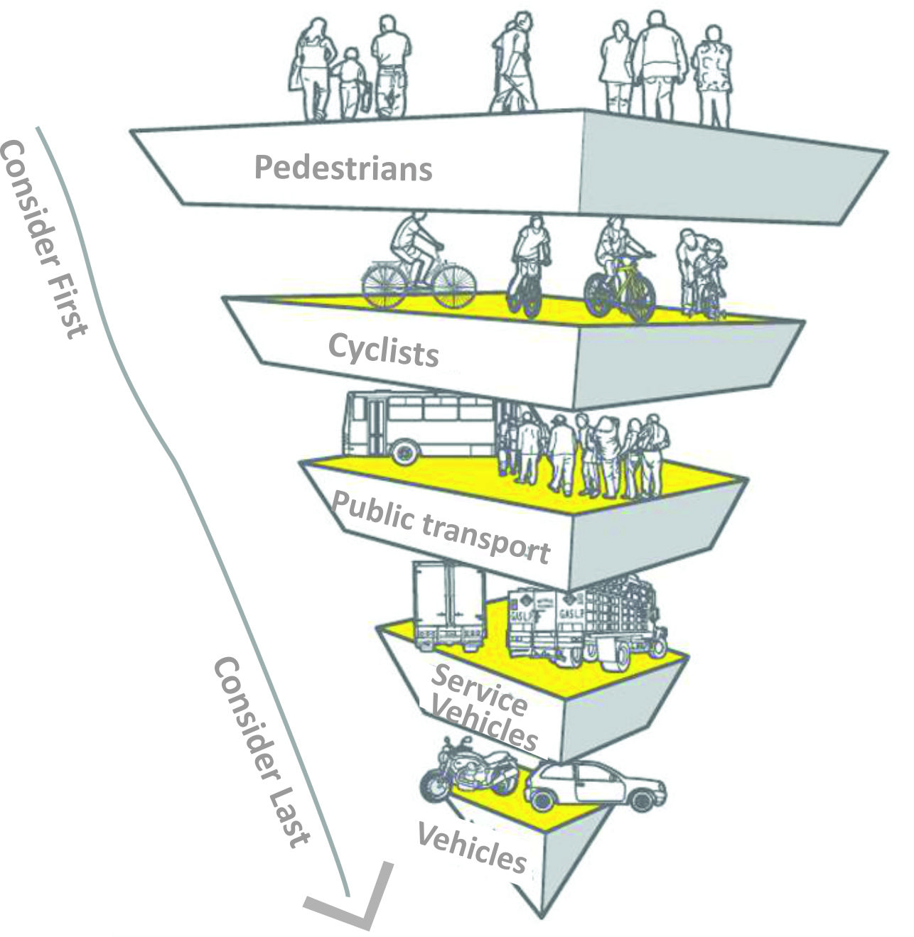
Recommended Movement Hierarchy
In considering the potential of new development, making the right connections into and out of the site is a major component of placemaking. The distribution and hierarchy of streets have an important relationship with distribution of land uses, density and pattern of activity.
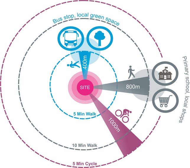
Ideally, all new homes will be built to be within a walking distance of 400m (5mins walk) of a bust stop and local green space and a distance of 800 (10mins walk) to local shops primary school and other areas of amenity space. The diagram below illustrates the movement distances to key services and amenity space.
Creating new walking routes and connecting to existing walking and cycling routes by the simplest and most direct way should be a major consideration and priority in all new developments in North Norfolk.
Streets must also meet the technical requirements as set out within ‘Manual for Streets’ and ‘Manual for Streets 2' publications. The underlying principle should be that streets as spaces should take precedent over engineering considerations. These considerations should be addressed through the creation of a movement hierarchy, with different streets having a specific character linked to their role and function. As appropriate street hierarchy should be created with primary, secondary and tertiary streets being identified. Streets for primary vehicular movement should have clearly defined pavements and cycle lanes. In quieter places, low speed streets should make provision to share the space between pedestrians, bicycles and cars.